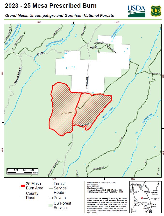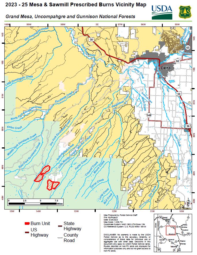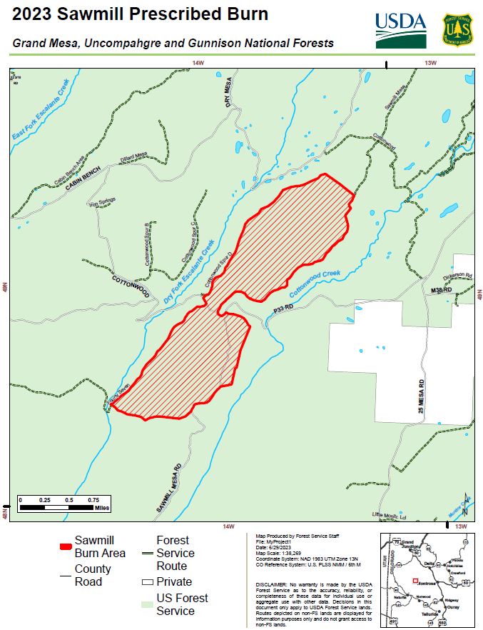
25 Mesa and Sawmill Mesa Prescribed Burns Planned- Up to 2600 acres targeted for treatment with prescribed fire in Montrose and Mesa Counties
Montrose, Colorado, July 3, 2023 — Fire Management Officials from the Grand Mesa, Uncompahgre and Gunnison (GMUG) National Forests’ Ouray Ranger District plan to conduct the 25 Mesa prescribed burn July 6, depending upon weather and appropriate ground and vegetation conditions. After the 25 Mesa prescribed burn is completed and if conditions remain favorable, fire managers will then conduct the Sawmill Mesa prescribed burn.
The prescribed burns are located approximately 25 miles west of Delta, Colorado on 25 Mesa road–National Forest System Road #503. Up to 2600 acres are planned to be burned to increase the resiliency and reproduction of native ponderosa pine stands, protect adjacent private property from the spread of unplanned wildfires, improve wildlife habitat and reduce slash from mechanical treatments.
Fuel moisture, weather and soil moisture conditions differ at elevations. Both projects are located above 8,300 feet in elevation where vegetation is still in the green up process and fuel and soil moisture content is higher compared to lower elevations. Below normal temperatures, combined with above average precipitation this spring, provided ideal conditions for burning at higher elevations. Currently, the Rocky Mountain Region is at a Preparedness Level 2, meaning geographic areas are able to manage fire activity without requesting many wildland fire suppression resources from other areas. The Preparedness Level and the predicted moderated fire weather factors into the extensive planning process for these projects.
Prescribed burning is a tool that re-introduces fire into the ecosystem to promote and regenerate healthy trees and habitat conditions. Before conducting a prescribed burn, extensive planning takes place to establish proper parameters such as weather, fuel conditions, smoke dispersion, staffing and other agency coordination. Significant coordinating efforts occur with local landowners, protection partners and other cooperating agencies to ensure the burn is conducted safely.
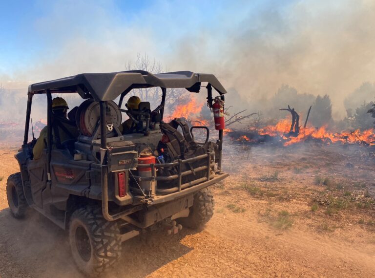
The prescribed burns will be accomplished using joint-agency fire resources utilizing aerial and hand ignitions and will be closely monitored to ensure that they remain within the designated boundaries. In an effort to provide additional resources to the projects, a special Prescribed Fire Incident Management Team will be deployed specifically for these projects and weather stations will be established to monitor and predict wind and humidity conditions at the project sites. Extra patrols will also monitor the prescribed fires and mop-up the perimeter fire lines.
As part of the team, an Air Resource Advisor will also be assigned to the prescribed burns and air quality will be closely monitored to mitigate smoke related impacts to communities. Smoke may be visible in Norwood, Telluride, Montrose and Ridgway communities for several days and may impact Sanborn Park area residents.
The safety of firefighters and the public are the most important factors considered when planning prescribed fires. Fire managers have obtained smoke permits from the State of Colorado and will comply with Colorado State air quality regulations. For more information on how prescribed fire smoke may affect your health, please visit: https://www.colorado.gov/pacific/cdphe/wood-smoke-and-health.
The public is reminded not to call 911 or emergency services if smoke is visible in specific burn areas. Prescribed burn updates will be posted on the GMUG Fire Info page. For information on prescribed burns, pile burns, wildfires and fire restrictions on National Forest System lands visit www.westslopefireinformation.com.
For more information on Wildland Fire Preparedness Levels visit https://www.nifc.gov/fire-information#current-levels.
For information and updates on current fire restrictions, conditions, and recreation opportunities on the Grand Mesa, Uncompahgre and Gunnison (GMUG) National Forests visit the forest website. Connect with us on social media (Twitter and Facebook).