Nourse Fire Update
Sunday, July 30, 2023
Contact: Deana Harms 970-403-5576
For updated information follow our social media outlets:
Facebook: @BLMMontroseFireUnit
Twitter: @SWD_Fire
Montrose Interagency Dispatch website: //www.wildwebe.net/?dc_name=COMTC
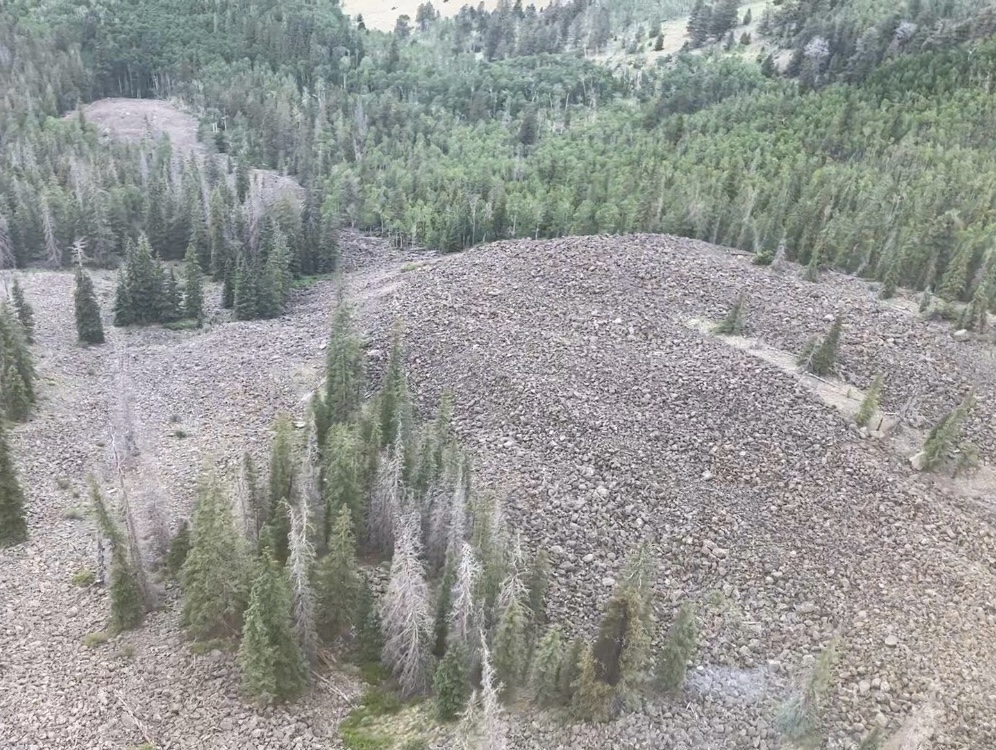
Location: Approx. 5.5 miles northeast of Lake City, CO
Jurisdiction: Bureau of Land Management Discovered: July 27, 2023, 4:30 PM
Cause: Lightning Vegetation Type: Mixed Conifer Trees
Estimated Size: 0.1 acre Containment: 0%
Strategy: Full Suppression
Current Status: The Nourse Fire is burning in the Powderhorn Wilderness on public lands managed by the BLM Gunnison Field Office. The fire is burning at 10,280 feet elevation in a small stringer of mixed conifers surrounded by a rock scree field and is being monitored by firefighters and air resources. Single tree torched and creeping fire behavior was reported on July 27 and the fire is currently showing minimal activity.
Planned Actions: The Nourse Fire is being managed as a full suppression fire, using natural barriers for containment to increase firefighter safety. Challenges include remote and steep terrain, making access for fire personnel and approaches to firefighting more difficult. Fire managers continue to assess conditions to implement tactics and strategies that increase containment success.
Evacuations and Closures: No evacuations or closure orders have been issued.
Smoke: Smoke is visible from surrounding areas and Highway 149. Go to https://fire.airnow.gov to get updated smoke conditions in North America.
Aviation Safety: Aircraft may be used over the Nourse Fire air space. Fire aviation resources are flying at different altitudes and speeds. Pilots should exercise caution when flying near wildfires to keep everyone safe. Unmanned aircraft systems (UAS) or drones must never fly near wildfires, as UAS are difficult to see and drone pilots have no way of communicating with firefighting aircraft. The only UAS or drones able to fly are agency owned and operated and have been assigned to work on the wildfire and have communication with air operations. Remember if you fly, we can’t!