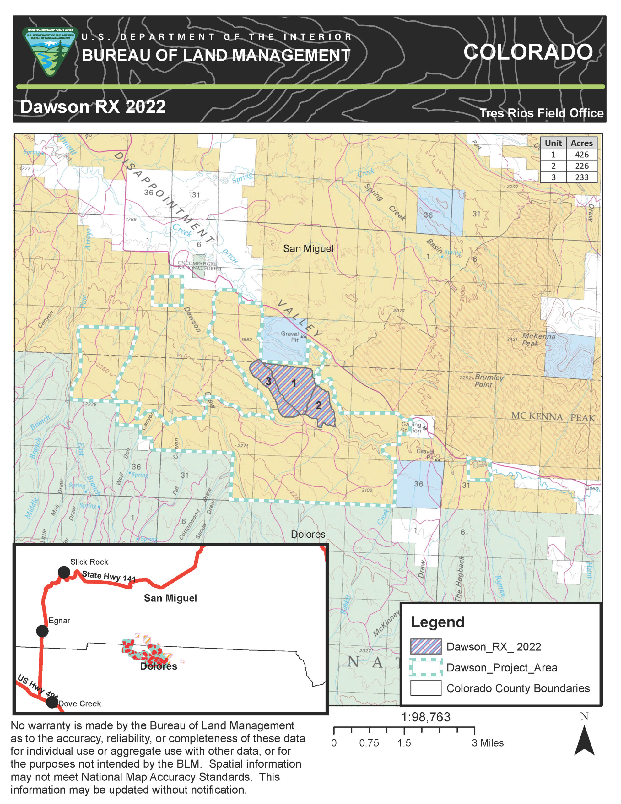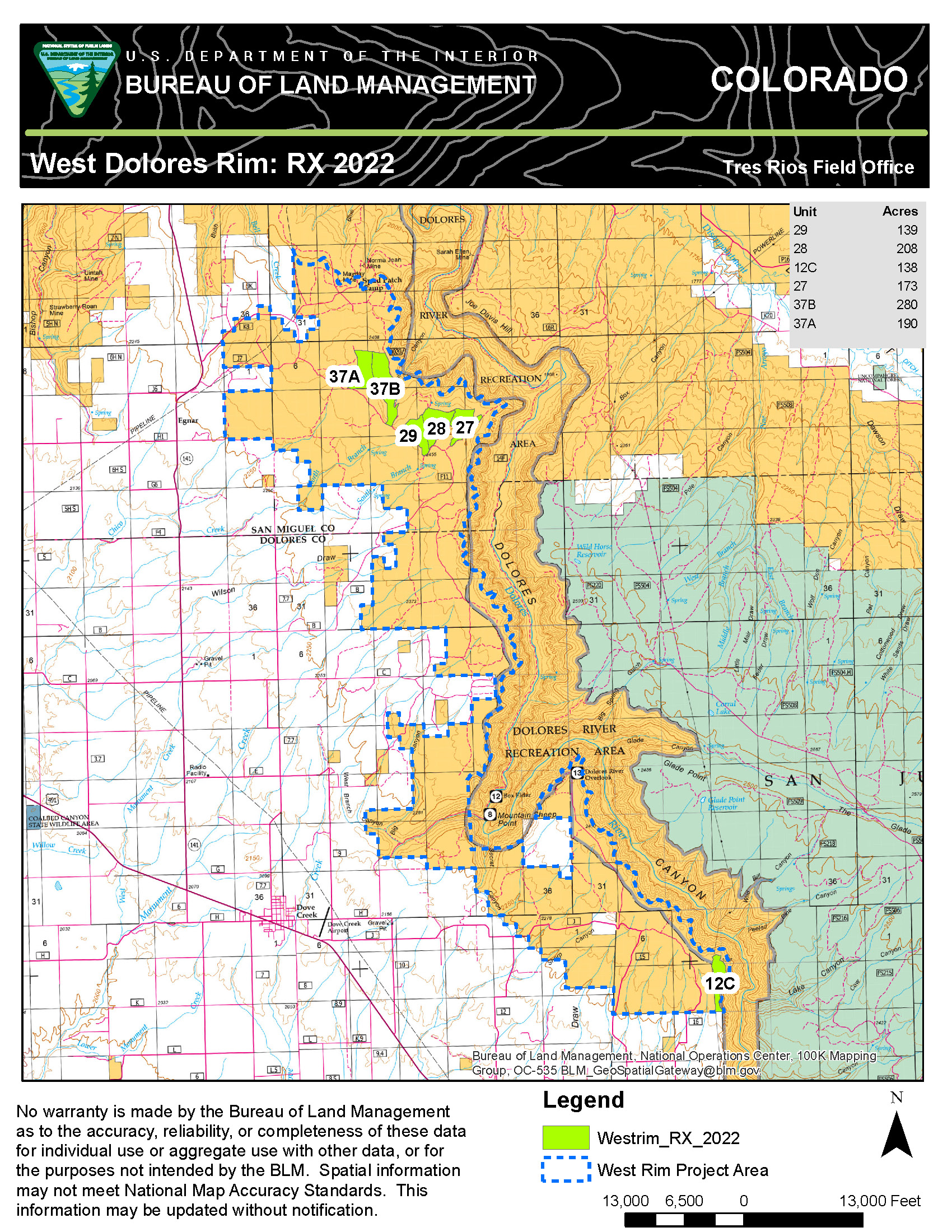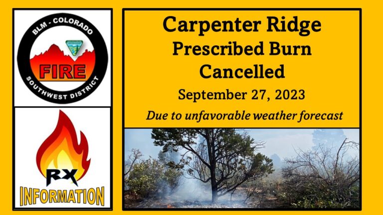
DOLORES, Colo. – The Bureau of Land Management Tres Rios Field Office plans to conduct several prescribed burns beginning April 15 or as conditions allow. The burns will treat up to 885 acres of pinyon, juniper, and mixed mountain shrub within the Dawson Project Area. The project area is split between San Miguel and Dolores counties, located 13 miles east-northeast of Dove Creek and 10 miles east of Egnar. In addition, crews will continue treating up to 1,900 acres of ponderosa pine and Gambel oak within the West Dolores Rim Project Area, located about seven miles east of Dove Creek and locally referred to as the “East and North Pines.”
The planned burns are part of a larger project to reduce hazardous fuels, protect wildland-urban interface communities, improve big game habitat, sage grouse habitat, range conditions, and reintroduce fire to a fire-adapted ecosystem to restore healthy forests and species diversity. Last year, several West Dolores Rim Project units were successfully treated and are already showing signs of improved habitat.
“Both project areas have detailed prescribed burn plans outlining specific parameters that must be met to ensure the burn is controlled successfully”, said Tyler Corbin, acting BLM Fire Management Specialist. “We will continue to monitor weather conditions and air quality to minimize the potential for smoke impacts on the health and safety of our communities and fire resources.”
While no road closures are expected during the project, camping near the units is discouraged due to increased traffic and the likelihood of smoke in the area, particularly at night. As fuel conditions and weather permit, multiple days of burning may occur throughout the spring into summer and then again in the late summer into fall. Project areas will be monitored once completed to ensure public safety. While smoke may be visible in the area at times, most of the smoke will lift and dissipate during the warmest parts of the day. Expect visible smoke in the area for several days after each burn is completed as vegetation in the interior continues to smolder.
The BLM obtained smoke permits from the Colorado State Air Pollution Control Division, which identify atmospheric conditions under which the burns can be implemented. Prescribed fire smoke may affect your health. For more information, visit https://www.colorado.gov/pacific/cdphe/wood-smoke-and-health.
For information on prescribed burns, visit the Southwest District BLM Prescribed Fire InciWeb page (https://inciweb.nwcg.gov/incident/7852/) or follow us on Twitter (https://twitter.com/SWD_Fire) and Facebook (http://www.facebook.com/BLMMontroseFireUnit).