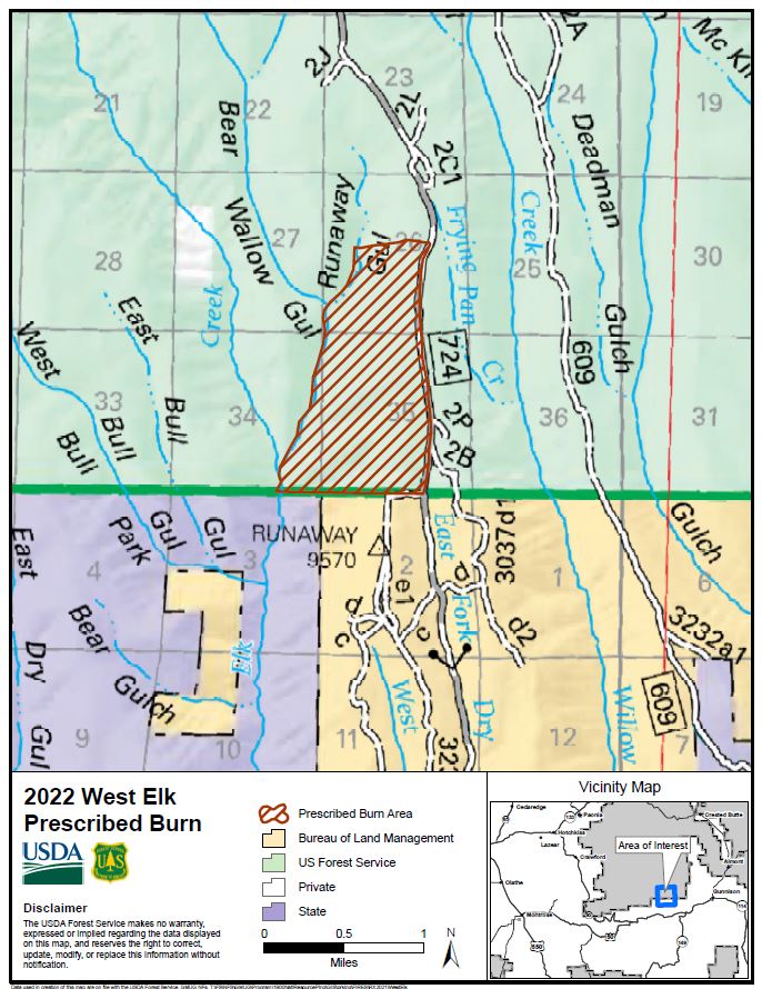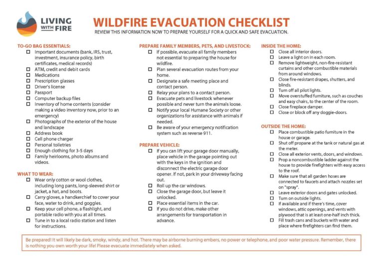
Gunnison, Colorado, April 4, 2022 – Fire Management Officials from the Grand Mesa, Uncompahgre and Gunnison (GMUG) National Forests’ Gunnison Ranger District plan to conduct the West Elk prescribed burn beginning April 4, depending upon weather and appropriate ground and vegetation conditions.
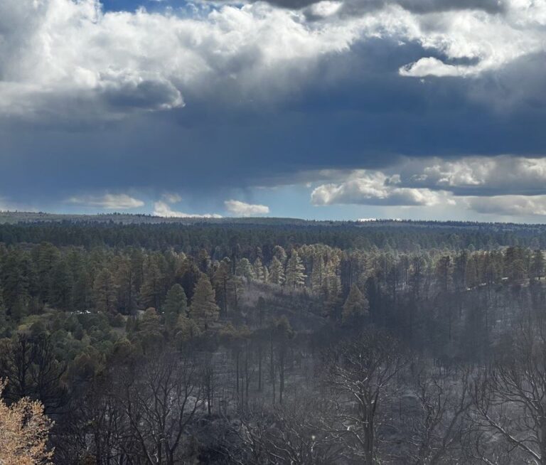
The prescribed fire is located approximately 14 miles west of Gunnison, Colorado and 5 miles north of Blue Mesa Reservoir. Approximately 100 acres are planned to be burned to reduce vegetation (fuels) and improve wildlife habitat along National Forest System Road (NFSR) #724.
The prescribed burn will be accomplished using joint-agency fire resources. Air quality will be closely monitored to mitigate smoke related impacts to communities. Smoke may be visible in the Gunnison valley and along HWY 50 between Gunnison and Montrose.
The safety of firefighters and the public are the most important factors considered when planning prescribed fires. Fire managers have obtained smoke permits from the State of Colorado for each of the planned pile burns. For more information on how prescribed fire smoke may affect your health, please visit: https://www.colorado.gov/pacific/cdphe/wood-smoke-and-health .
For information on prescribed burns, pile burns, wildfires and fire restrictions on National Forest System lands visit the GMUG Fire Info page or www.westslopefireinformation.com.
For information and updates on current fire restrictions, conditions, and recreation opportunities on the GMUG visit the forest website. Connect with us on social media (Twitter and Facebook).
For more information on how prescribed burning and pile burning smoke may affect your health, please visit: https://www.colorado.gov/pacific/cdphe/wood-smoke-and-health.