For Immediate Release: Steamboat Rocks Prescribed Burn Planned
Fire Management Officials from the Grand Valley Ranger District plan to conduct the Steamboat Rocks prescribed burn beginning May 17, depending upon weather and appropriate ground and vegetation conditions.
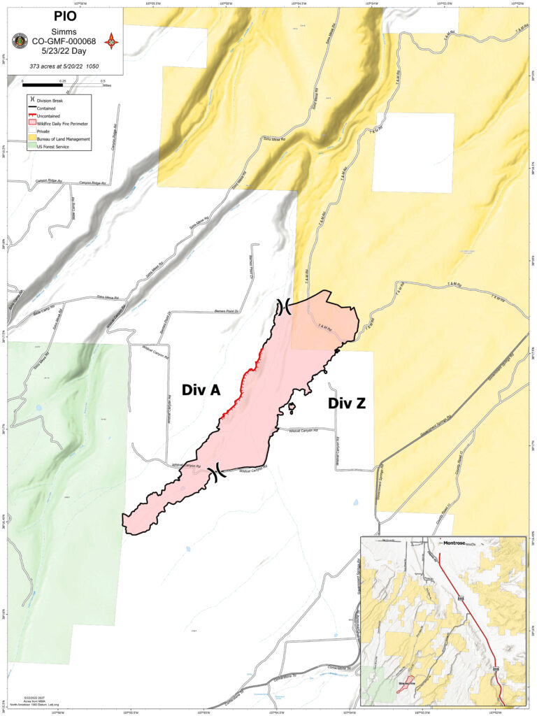
The prescribed fire is located south of the Lands’ End road–National Forest System Road #101, 6 miles south of Grand Junction, Colorado, within Mesa County. Approximately 500–1,000 acres are planned to be burned to reduce the threat of wildfire to the City of Grand Junction municipal watershed and improve wildlife habitat.
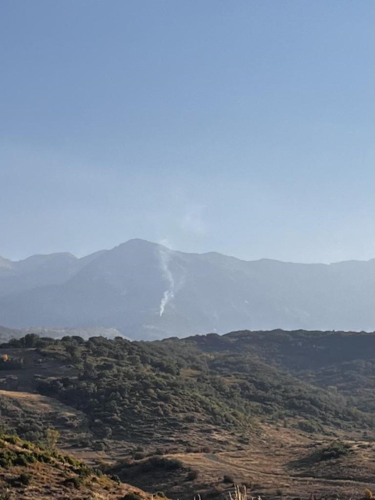
The prescribed burn will be accomplished using joint-agency fire resources utilizing aerial and hand ignitions. Air quality will be closely monitored to mitigate smoke related impacts to communities. Residual smoke may be visible in Grand Junction, Whitewater, Gateway, and Fruita communities for several days.
The safety of firefighters and the public are the most important factors considered when planning prescribed fires. Fire managers have obtained smoke permits from the State of Colorado. For more information on how prescribed fire smoke may affect your health, please visit: https://www.colorado.gov/pacific/cdphe/wood-smoke-and-health .
The public is reminded not to call 911 or emergency services if smoke is visible in specific burn areas. Prescribed burn updates will be posted on the GMUG Fire Info page. For information on prescribed burns, pile burns, wildfires and fire restrictions on National Forest System lands visit www.westslopefireinformation.com.