South Rim Evacuation Map
Click here to open the interactive South Rim Evacuation Map. To search by address, click the search button on… Continue Reading South Rim Evacuation Map

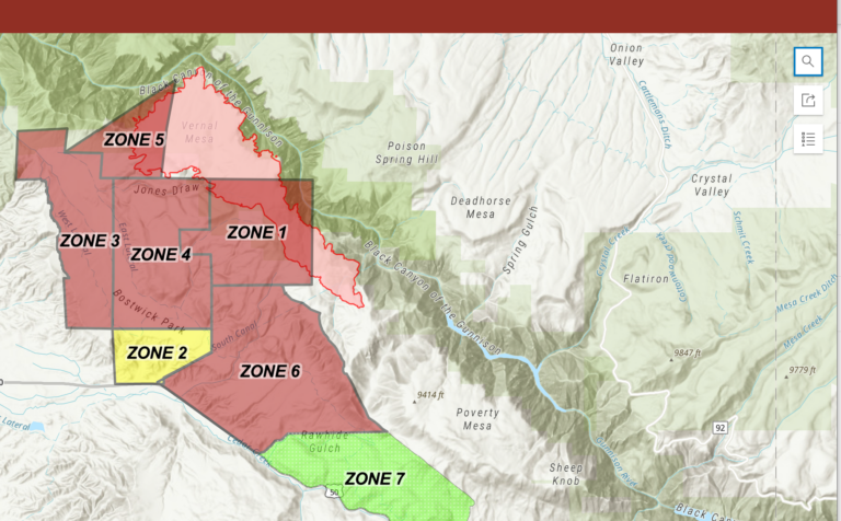
Click here to open the interactive South Rim Evacuation Map. To search by address, click the search button on… Continue Reading South Rim Evacuation Map
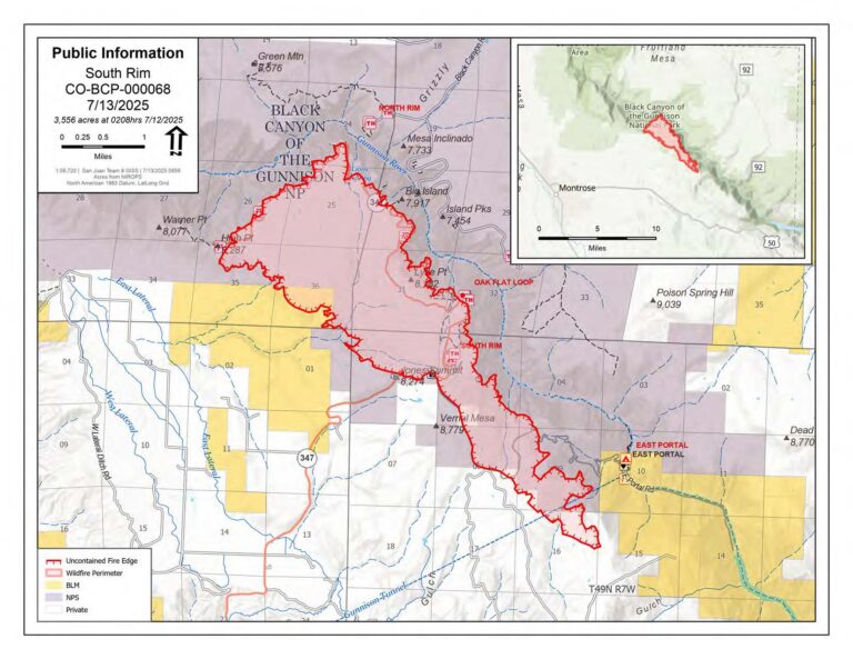
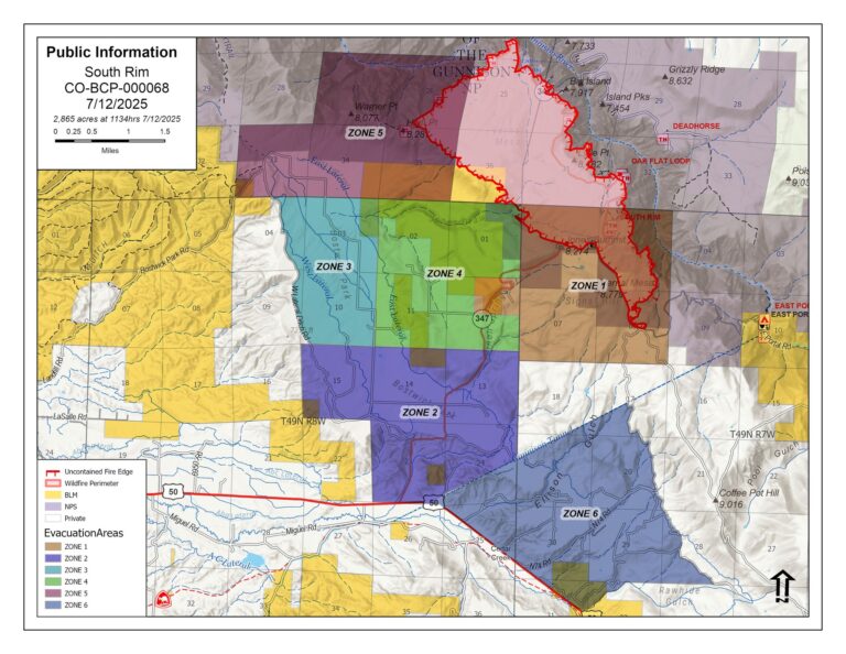
South Rim Fire Update July 14, 2025 South Rim Fire Update July 13, 2025 South Rim Fire Update July… Continue Reading South Rim Fire Updates
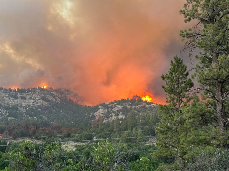
Due to extreme fire behavior in the Bostwick Park and K73 area, Zone 5, evacuate the area immediately. This… Continue Reading EVACUATION NOTICE

Emergency Shelter Assistance Available Due to the evacuation and displacement of residents in the Bostwick Park area, the Montrose… Continue Reading Emergency Shelter Assistance
Evacuations have been issued by Montrose County for residences on M73, N73, N74, and O74 roads due to the… Continue Reading Evacuation Alert
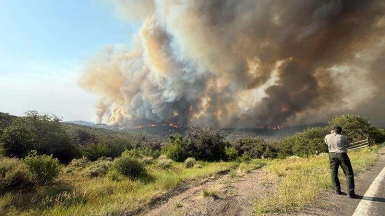
Wildfire Evacuation – rapidly moving wildfire in the area, all residents in Bostwick Park and up Highway 347 including… Continue Reading Bostwick Park Evacuation
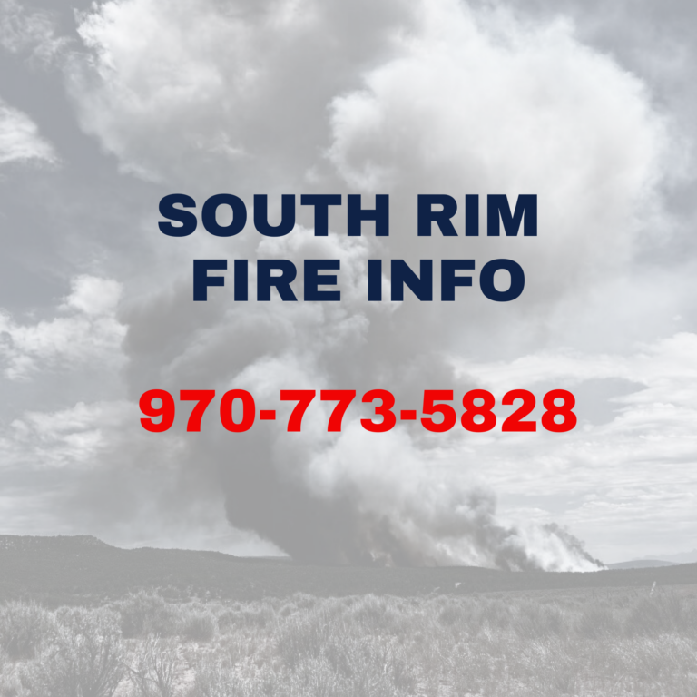
For information pertaining to the South Rim Fire: Phone (970) 240-1070 Websites Inciweb www.westslopefireinfo.com
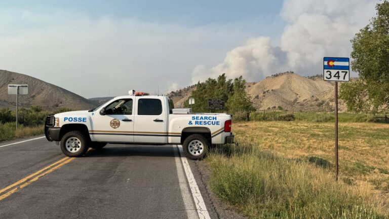
Hwy 347 is closed at the junction of Hwy 50. The public is asked to stay clear of the… Continue Reading Highway 347 Closed at junction of 50
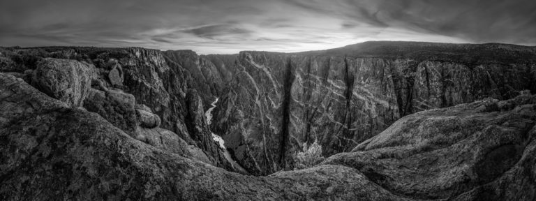
Montrose, Colo. – On the morning of July 10, 2025, lightning strikes ignited wildfires on both the North Rim… Continue Reading Wildfires close Black Canyon of the Gunnison National Park – Black Canyon Of The Gunnison National Park (U.S. National Park Service)